1731-1743: Transportation and Exploration & Other Quebec Curios
Part of “Je me souviens: New France, 1534–1763”
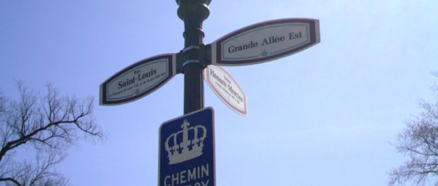
 A sign marking the road that used to be the Chemin du Roy, New France's first highway. Photo credit: Azumanga1/Wikimedia Commons.
The Treaty of Utrecht, though a war focussed on European succession, unfortunately spilled over to the New World and its colonies. From sieges in Acadia to the eventual renunciation of Hudson’s Bay, New France seemed to have hit a rough spot in its growth. However, this did not stop the colony of New France from growing even more. By around 1700, the city of Quebec’s population hit about 2000 people, and Montreal just under 3000; in total, New France’s population as a whole was a bit more than 17 000 scattered amongst the vast territory. At this point in time, New France’s settlement extended through to territory around the shores of the Saint Lawrence River, to pockets of Louisiana and parts of modern-day Illinois. The territory, however, was by no means the monstrous piece of territory ceded to Britain after the French and Indian War. Still, for a territory that started to grow, it would need more infrastructure to accommodate the colony’s growth, especially for the trade that would occur between New France’s three major settlements: Quebec, Montreal, and Trois-Rivières. For this, a road would have to be built: a King’s Road, no less.
As early as the first few years of 1700, before the Treaty of Utrecht, the King’s council for New France ordered a road to be built in New France, facilitating travel and transport through the settlements located around the Saint Lawrence River. With the setback of the War of the Spanish Succession, these plans halted, but after the war, in 1731, they picked back up again. The Chemin du roy, or King’s Road (not unlike the one in the series “Game of Thrones”) became a major infrastructure project under the watchful eyes of surveyor Eustache Lanouiller de Boisclerc. Boisclerc’s workers were workers hired for the job, but also included everyday people, who had to cooperate in order to provide passage (corvée) so that the road could be built. When construction of this route finished in 1737, this proto-highway was the longest and largest in North America, and helped facilitate not only mail and transportation, but also linked thirty-seven seigneuries with each other. Going from Montreal to Quebec would now be a journey of about six days at most.
New France would grow even further in terms of the scope of its territory following the Treaty of Utrecht. Explorers such as Pierre Gaultier de Varennes, sieur de La Vérendrye and his sons would travel west and explore parts of modern day Saskatchewan, Alberta, and Manitoba. His sons, Jean Baptiste, Pierre, François, and Louis-Joesph would also explore lands in the name of New France. Louis-Joseph, in particular, would reach territory as far as the Rocky Mountains. By the end of the 1750s, New France’s territory would expand to all the territory between the Saint Lawrence River’s shores to Louisiana, and not just pockets of territory. It would extend as far west as Saskatchewan and as far east as Labrador. It did not, however, include Acadia, nor two small islands off Labrador’s coast, St. Pierre and Miquelon, two uninhabited fishing communities; both these islands and Acadia had been ceded to England, of all places, during the War of the Spanish Succession. But these territories, including the ones ceded to England, would remain important and a source of conflict between England and France. When the French and Indian War erupted in 1754, the English would shake up the very core of New France—it would be the beginning of the end for the French colony.
Autoroute 138 follows more or less the same route as the Chemin du roy did. Visit the shops and learn more about this historic landmark here.


